| DOCUMENT TYPE: FIELD REPORT / URBAN LEGEND CASE FILE | DOC-ID: ARC-1962-4419 |
| CLASSIFICATION: TOP SECRET // NOFORN | ARCHIVE DATE: 2026.04.23 |
| LEAD RESEARCHER: Dr. E. Petrenko, Dept. of Anomalous Ethnography | INCIDENT SITE: 49°45’N, 78°42’E — Semipalatinsk Test Zone, Kazakh SSR |
▌ ENGLISH SECTION — PRIMARY DOCUMENTATION
I. CASE OVERVIEW
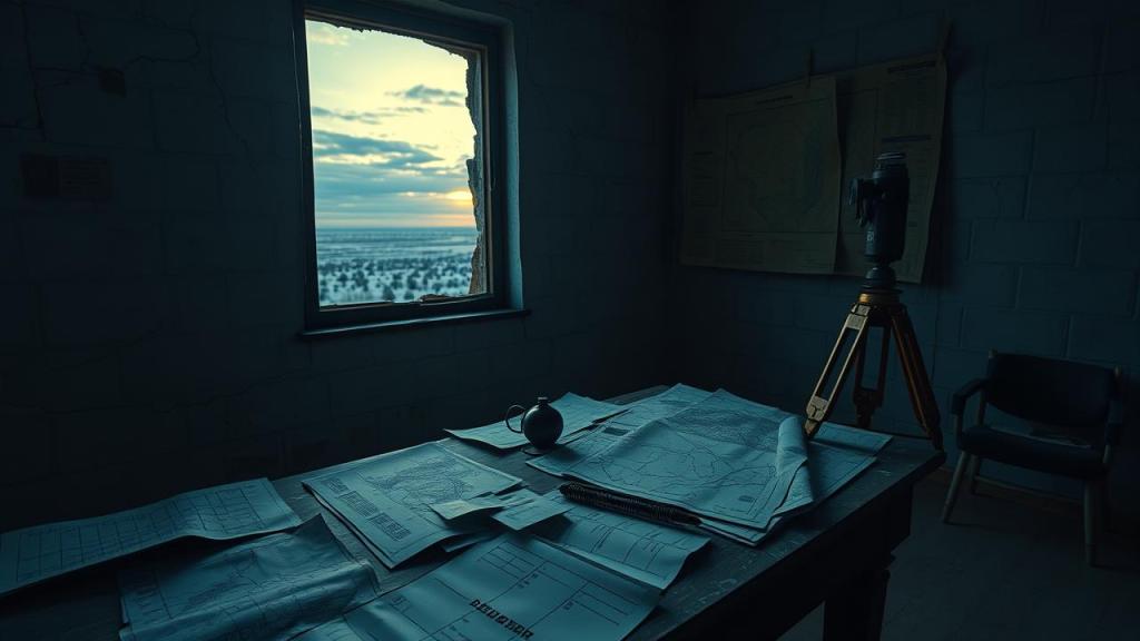
In the late summer of 1961, a state-employed land surveyor by the designation Dmitri Alexeyevich Vasilyev was dispatched under Order No. 337-GK to conduct topographic surveys of restricted Zone 7-P adjacent to the Semipalatinsk Nuclear Test Site, Kazakh Soviet Socialist Republic. Vasilyev, a decorated specialist with twelve years of service under the Central Geodetic Survey Bureau (CGSB), departed the survey camp at coordinates 49°45’N, 78°42’E on the morning of 14 August 1961 and failed to return by the stipulated deadline of 22 August. A subsequent search operation, designated ROZA-4, recovered his field equipment, transit theodolite, and surveying rods — but no remains, no personal effects, and no indication of accident or foul play. His case was formally closed as “missing in restricted territory” under Directive K-19 and sealed until 1991.
The subject’s disappearance would have remained an obscure administrative anomaly were it not for the subsequent emergence — on three separate occasions across four decades — of cartographic documents bearing Vasilyev’s official survey stamps and handwriting notations, depicting in precise geodetic detail a cluster of settlements and infrastructure that no official Soviet or post-Soviet registry has ever acknowledged. This phenomenon, first codified by ethnographic researcher Dr. E. Petrenko of the Almaty Institute of Anthropological Studies in 2004, has since generated significant clandestine interest among both academic folklorists and former intelligence analysts.
II. SUBJECT BACKGROUND
Dmitri Alexeyevich Vasilyev (b. 1924, Saratov Oblast) was recruited into the Central Geodetic Survey Bureau in 1949 following distinguished service as a military cartographer during the later stages of the Second World War. Bureau personnel records — partially declassified under the 1995 Kazakhstan State Archive Accessibility Act — describe him as methodical, politically reliable, and possessing an unusually high tolerance for extended solo fieldwork in hostile terrain. He was rated Class I Specialist in both triangulation and spirit leveling, and had previously surveyed four restricted territories without incident, including the Usturt Plateau closure zone (1954) and the Baikonur provisional exclusion perimeter (1957).
Colleagues interviewed by Dr. Petrenko’s research team in 2004–2006 described Vasilyev as a man of precise habits. Former Bureau associate Nikolai Greshkov (interviewed 2005, deceased 2009) stated: “Dmitri never left a grid square incomplete. He would not have abandoned his instruments voluntarily. Whatever happened to him was not of his choosing.” No evidence of radiological contamination was discovered on the recovered equipment, which was confirmed by a 1994 re-examination conducted by the Kazakh Nuclear Safety Agency under Project Reference KNB-4419.
III. THE ANOMALOUS CARTOGRAPHIC ARTIFACTS
The first of the so-called Vasilyev Maps was discovered in 1978 by archivist Lena Sartova during routine reorganization of the Semipalatinsk Oblast Geodetic Archive. The document — a 1:25,000 scale topographic sheet, bearing Vasilyev’s Bureau stamp (No. 4-GK-1961) and dated 17 August 1961 — depicted a settlement of considerable complexity located approximately 34 kilometers northeast of the known survey camp perimeter. The settlement featured labeled streets, a central administrative building identified as “Объект Д” (Object D), a rail spur connecting to an unnamed junction, and contour lines indicating subterranean construction at depths consistent with deep bunker architecture. No such settlement appears on any classified or unclassified map of the region. Sartova reported the document to the Oblast KGB office; the document was subsequently confiscated, and Sartova was instructed not to discuss the matter further.
The second appearance occurred in 1993, when a near-identical document surfaced during the liquidation of the Almaty Central State Archive annex. The map, indistinguishable in paper composition, ink aging, and drafting style from genuine 1961-era Bureau survey products, depicted the same settlement with minor but significant differences: the administrative building now bore the annotation “EVACUATED 1963,” and several residential blocks were marked with red cross-hatch notation indicating demolition. Independent forensic document examination, commissioned by Dr. Petrenko in 2007, confirmed the paper and ink composition as consistent with materials available only in Soviet government stockrooms prior to 1965, ruling out modern forgery as a viable explanation. The third known map surfaced in 2019 in a private collection in Nur-Sultan; its current location is undisclosed.
IV. FOLKLORIC PROPAGATION AND CULTURAL SIGNIFICANCE
By the mid-1990s, the Vasilyev case had entered regional oral tradition in the Semipalatinsk and Pavlodar oblasts as the legend of “Картограф без тени” — the Cartographer Without a Shadow. The legend holds that Vasilyev discovered and mapped a settlement that exists outside normal space-time, a place referred to in local Kazakh tradition as “Жер асты қала” (the Underground City). According to the legend, the surveyor’s professional compulsion to complete his grid prevented him from departing once his instruments had located the settlement; he remains there still, perpetually re-surveying the same coordinates. His maps, according to the legend, surface in archives not because they were forgotten but because Vasilyev continues to submit his completed fieldwork through channels that should no longer be accessible to him.
Ethnographic fieldwork conducted in the villages of Kaynar and Znamenka (2005–2008) documented consistent motifs: witnesses described encountering a thin, formally dressed man on the steppe at dawn, carrying surveying equipment and walking in precise, measured paces along invisible grid lines. No interaction with the figure was reported in any documented instance; witnesses noted that the figure did not cast a shadow regardless of the angle of sunlight. Two of the seven interviewed witnesses refused to describe the figure’s face on the grounds of personal distress, offering instead a standard Kazakh apotropaic phrase used to deflect misfortune.
V. ANALYTICAL ASSESSMENT
Dr. Petrenko’s 2011 monograph, “Spectral Cartography: The Vasilyev Phenomenon and Liminal Space in Soviet Folklore” (unpublished, Almaty Institute working paper WP-2011-07), proposed three non-exclusive analytical frameworks: (1) the maps represent genuine documentation of a classified installation that has been retroactively denied through disinformation; (2) the maps are elaborate fabrications of unknown authorship constructed to exploit genuine uncertainty about Soviet-era classified activity; (3) the phenomenon represents a genuine folkloric encoding of spatial anxiety associated with nuclear contamination and state secrecy, in which the figure of the surveyor functions as a liminal psychopomp figure mediating between the known and forbidden landscape. Petrenko noted that frameworks (1) and (3) are not mutually exclusive, and that the forensic evidence strongly disfavors framework (2).
◆ FIELD DATA / INCIDENT LOG
INCIDENT-001 · 14 AUG 1961 · Vasilyev departs survey camp; last confirmed visual contact by field assistant P. Morozov at 06:14 local time.
INCIDENT-002 · 22 AUG 1961 · Failure to return. Search operation ROZA-4 launched. Equipment recovered at grid ref. 49°51’N 78°58’E; no remains located.
INCIDENT-003 · 03 NOV 1978 · Map No. 1 discovered by archivist L. Sartova, Semipalatinsk Oblast Geodetic Archive. Confiscated by KGB Oblast Office, Ref. K-78-4419.
INCIDENT-004 · 17 JUN 1993 · Map No. 2 surfaces during Almaty archive liquidation. Second confiscation, Ref. KNB-93-1104.
INCIDENT-005 · 2005–2008 · Ethnographic fieldwork by Dr. E. Petrenko; 7 witnesses report steppe apparition consistent with Vasilyev description.
INCIDENT-006 · 2019 · Map No. 3 appears in private collection, Nur-Sultan. Current custodian undisclosed. No confiscation on record.
▌ 한국어 섹션 — 기밀 번역 문서
I. 사건 개요
1961년 늦여름, 국가 소속 측량사 드미트리 알렉세예비치 바실리예프(Dmitri Alexeyevich Vasilyev)는 명령 제337-GK호에 따라 카자흐 소비에트 사회주의 공화국 내 세미팔라틴스크 핵실험장 인접 제7-P 제한구역의 지형 측량 임무를 부여받았다. 중앙측지측량국(CGSB)에서 12년간 복무한 우수 전문가로 분류된 바실리예프는 1961년 8월 14일 오전 좌표 49°45’N, 78°42’E의 현장 캠프를 출발하였으나, 규정된 귀환 기한인 8월 22일까지 복귀하지 않았다. 이후 진행된 수색 작전 ‘로자-4(ROZA-4)’는 그의 현장 장비, 트랜싯 트레오돌라이트, 측량봉을 회수하였으나 유해, 개인 소지품, 사고나 범죄의 흔적은 전혀 발견되지 않았다. 그의 사건은 지령 K-19에 의거하여 ‘제한구역 내 실종’으로 공식 처리되고 1991년까지 봉인되었다.
이 사건이 단순한 행정적 이례 사항으로 남지 않게 된 것은, 이후 40여 년에 걸쳐 세 차례에 걸쳐 바실리예프의 공식 측량 인장과 자필 주석이 담긴 지도 문서가 출현했기 때문이다. 이 지도들은 어떠한 공식적 소비에트 또는 탈소비에트 등록부에도 존재하지 않는 취락지와 기반시설 단지를 정밀 측지 기법으로 묘사하고 있었다. 이 현상은 2004년 알마티 인류학연구소의 민족지 연구자 E. 페트렌코 박사에 의해 처음으로 체계적으로 정리되었으며, 이후 학술 민속학자와 전직 정보 분석가들 사이에서 상당한 비공개적 관심을 불러일으키고 있다.
II. 대상자 배경
드미트리 알렉세예비치 바실리예프(1924년생, 사라토프 주)는 제2차 세계대전 후반기 군사 지도 제작자로서 뛰어난 복무 실적을 기반으로 1949년 중앙측지측량국에 입국하였다. 1995년 카자흐스탄 국가기록원 접근성 법령에 따라 부분적으로 비밀 해제된 국 인사 기록에 따르면, 그는 철저하고 정치적으로 신뢰할 수 있는 인물로 평가받았으며, 험준한 지형에서의 장기 단독 야외 작업에 대한 비범한 내성을 지닌 것으로 기록되어 있다. 그는 삼각측량 및 수준측량 분야의 1급 전문가 자격을 보유하였으며, 우스튜르트 고원 폐쇄 구역(1954)과 바이코누르 임시 제한 경계(1957)를 포함하여 이전에 네 곳의 제한구역을 아무런 문제 없이 측량한 경험이 있었다.
페트렌코 박사의 연구팀이 2004~2006년 사이에 인터뷰한 동료들은 바실리예프를 정확한 습관을 가진 인물로 묘사하였다. 전직 국 동료 니콜라이 그레시코프(2005년 인터뷰, 2009년 사망)는 다음과 같이 진술하였다: “드미트리는 결코 격자 구역 하나도 미완성으로 남기지 않았습니다. 그가 자발적으로 장비를 버렸을 리 없습니다. 그에게 일어난 일은 그의 의지와 무관한 것이었습니다.” 회수된 장비에서는 방사선 오염의 증거가 발견되지 않았으며, 이는 1994년 카자흐스탄 핵안전청이 사업 참조번호 KNB-4419 하에 실시한 재조사에서도 확인되었다.
III. 변칙적 지도 유물
이른바 ‘바실리예프 지도’ 중 첫 번째는 1978년 기록 담당자 레나 사르토바가 세미팔라틴스크 주 측지 기록보관소의 정기 재정리 작업 중 발견하였다. 1961년 8월 17일자로 표기되고 바실리예프의 국 인장(No. 4-GK-1961)이 찍힌 1:25,000 축척 지형도는, 알려진 측량 캠프 경계로부터 약 34킬로미터 북동쪽에 위치한 복잡한 취락지를 묘사하였다. 해당 취락지에는 표지된 도로, “객체 D(Объект Д)”로 명명된 중앙 행정 건물, 무명 분기점으로 연결되는 철도 지선, 깊은 벙커 구조에 부합하는 깊이의 지하 건설을 나타내는 등고선이 포함되어 있었다. 이 지역의 어떠한 기밀 혹은 비기밀 지도에도 해당 취락지는 존재하지 않는다. 사르토바는 이 문서를 주 KGB 사무소에 신고하였고, 문서는 이후 압수되었으며 사르토바에게는 더 이상 이 사안을 언급하지 말 것이 지시되었다.
두 번째 출현은 1993년 알마티 중앙국가기록보관소 별관 청산 과정에서 유사한 문서가 발견되면서 일어났다. 해당 지도는 종이 재질, 잉크 노화, 제도 양식 면에서 진본 1961년대 국 측량 산출물과 구별되지 않았으며, 동일한 취락지를 묘사하되 몇 가지 중요한 차이점을 포함하고 있었다. 행정 건물에는 “1963년 대피(EVACUATED 1963)”라는 주석이 추가되었으며, 여러 주거 구역에는 철거를 나타내는 붉은 빗금 표시가 적용되어 있었다. 2007년 페트렌코 박사가 의뢰한 독립적 법문서감정 결과, 종이와 잉크 성분이 1965년 이전에만 소비에트 정부 비축 창고에서 이용 가능했던 재료와 일치하는 것으로 확인되어 현대적 위조 가능성은 실질적으로 배제되었다. 세 번째 지도는 2019년 누르술탄의 개인 소장품에서 발견되었으며, 현재 소장자는 밝혀지지 않고 있다.
IV. 민속 전파 및 문화적 의의
1990년대 중반까지 바실리예프 사건은 세미팔라틴스크와 파블로다르 지역 구전 전통에 “그림자 없는 측량사(Картограф без тени)”라는 전설로 자리잡았다. 이 전설에 따르면, 바실리예프는 정상적인 시공간 밖에 존재하는 취락지를 발견하고 측량하였다고 하며, 그 장소는 카자흐 전통에서 “제르 아스트 칼라(Жер асты қала)”, 즉 ‘지하 도시’로 불린다. 전설은 측량사의 직업적 강박, 즉 측량 격자를 완성해야 한다는 의무감이 그가 취락지를 발견한 이상 그곳을 떠나지 못하게 하였다고 설명한다. 그는 지금도 동일한 좌표를 끝없이 재측량하고 있으며, 그의 지도가 기록보관소에 계속 등장하는 이유는 그것이 망각된 것이 아니라 바실리예프가 더 이상 접근 가능하지 않아야 할 경로를 통해 계속하여 완성된 야외 작업물을 제출하고 있기 때문이라고 전해진다.
2005~2008년 카이나르와 즈나멘카 마을에서 수행된 민족지 현장 조사에서는 일관된 주제가 기록되었다. 목격자들은 여명 무렵 초원에서 측량 장비를 들고 눈에 보이지 않는 격자선을 따라 정밀하게 측정된 보폭으로 걷는 수척하고 정장 차림의 남성과 마주쳤다고 진술하였다. 기록된 어떤 사례에서도 목격자가 그 인물과 직접 상호작용을 나눈 것은 없었다. 목격자들은 햇빛의 각도와 무관하게 그 인물이 그림자를 드리우지 않았다고 일관되게 언급하였다. 인터뷰에 응한 일곱 명의 목격자 중 두 명은 개인적 고통을 이유로 그 인물의 얼굴 묘사를 거부하며, 대신 불행을 막기 위한 표준적인 카자흐 벽사 문구를 낭송하였다.
V. 분석적 평가
페트렌코 박사의 2011년 미출판 연구 논문 “스펙트럴 카르토그래피: 바실리예프 현상과 소비에트 민속에서의 경계 공간”(알마티 연구소 작업 논문 WP-2011-07)은 상호 배타적이지 않은 세 가지 분석 틀을 제안하였다. 첫째, 지도들은 역정보를 통해 소급하여 부인된 기밀 시설에 대한 실제 문서화일 가능성이다. 둘째, 소비에트 시대 기밀 활동에 관한 진정한 불확실성을 활용하기 위해 출처 미상의 저자가 제작한 정교한 위조물일 가능성이다. 셋째, 핵 오염과 국가 비밀에 결부된 공간적 불안의 진정한 민속적 부호화로서, 측량사의 형상이 알려진 영역과 금지된 영역 사이를 중재하는 경계적 심령 인도자로 기능하는 것일 가능성이다. 페트렌코는 첫 번째와 세 번째 틀이 상호 배타적이지 않으며, 법문서감정 증거는 두 번째 가능성을 강력하게 배제하는 방향으로 작용한다고 지적하였다.
◆ 현장 데이터 / 사건 기록
사건-001 · 1961년 8월 14일 · 바실리예프, 현장 캠프 출발. 현장 보조원 P. 모로조프에 의해 현지시각 06시 14분 마지막으로 육안 확인됨.
사건-002 · 1961년 8월 22일 · 미귀환. 수색 작전 ROZA-4 개시. 격자 좌표 49°51’N 78°58’E에서 장비 회수. 유해 미발견.
사건-003 · 1978년 11월 3일 · 제1호 지도, 세미팔라틴스크 주 측지 기록보관소에서 기록 담당자 L. 사르토바에 의해 발견. KGB 주 사무소 압수, 참조번호 K-78-4419.
사건-004 · 1993년 6월 17일 · 제2호 지도, 알마티 기록보관소 청산 과정에서 출현. 2차 압수, 참조번호 KNB-93-1104.
사건-005 · 2005~2008년 · E. 페트렌코 박사 민족지 현장 조사. 7명의 목격자, 바실리예프 특징과 일치하는 초원 출현 현상 보고.
사건-006 · 2019년 · 제3호 지도, 누르술탄 개인 소장품에서 발견. 현 소장자 미상. 압수 기록 없음.
THIS DOCUMENT IS CLASSIFIED — UNAUTHORIZED ACCESS IS PROHIBITED
본 문서는 기밀 자료입니다 — 무단 열람은 엄격히 금지됩니다
